Are you tired of generic vacation destinations that leave you feeling underwhelmed?
National parks offer something completely different. These protected landscapes showcase America’s natural wonders, from towering desert canyons to pristine alpine lakes, creating photo opportunities and memories that last a lifetime.
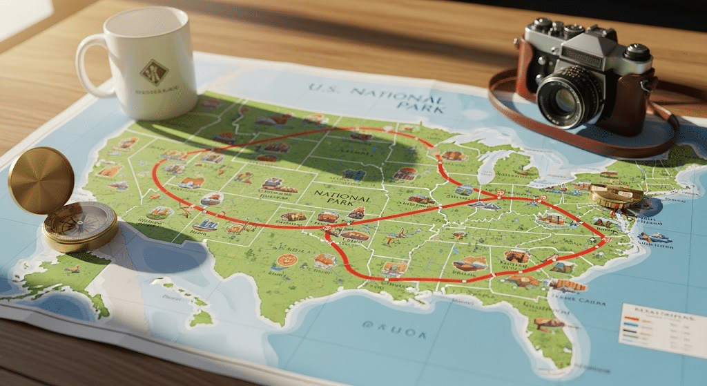
Your national park road trip map opens doors to experiences you simply cannot find elsewhere.
Each park offers unique ecosystems and wildlife encounters that commercial destinations cannot match. The right national park road trip map strategy connects parks logically and follows seasonal weather patterns.
Smart route selection transforms ordinary vacations into extraordinary experiences through America’s treasured landscapes.
Why National Parks Make the Best Road Trip Destinations?
National parks offer the most diverse and stunning landscapes in America.
With 63 national parks spread across 30 states, covering over 84 million acres, you have endless options for multi-park adventures.
Each park provides unique experiences you can’t find anywhere else. From towering mountains to desert canyons, ancient forests to pristine lakes, these protected areas showcase nature at its finest.
- Experience diverse ecosystems in one trip
- See iconic landmarks and natural wonders
- Enjoy activities like hiking, wildlife viewing, and photography
- Visit year-round with different seasonal highlights
- Access well-maintained roads and facilities
- Learn about local history and geology
A national park road trip map connects these incredible destinations efficiently. You can visit multiple parks and see how landscapes change across regions.
Smart planning helps you maximize your time and create the perfect itinerary. The variety keeps every day of your trip exciting and memorable.
National Park Road Trip Map: Route Options
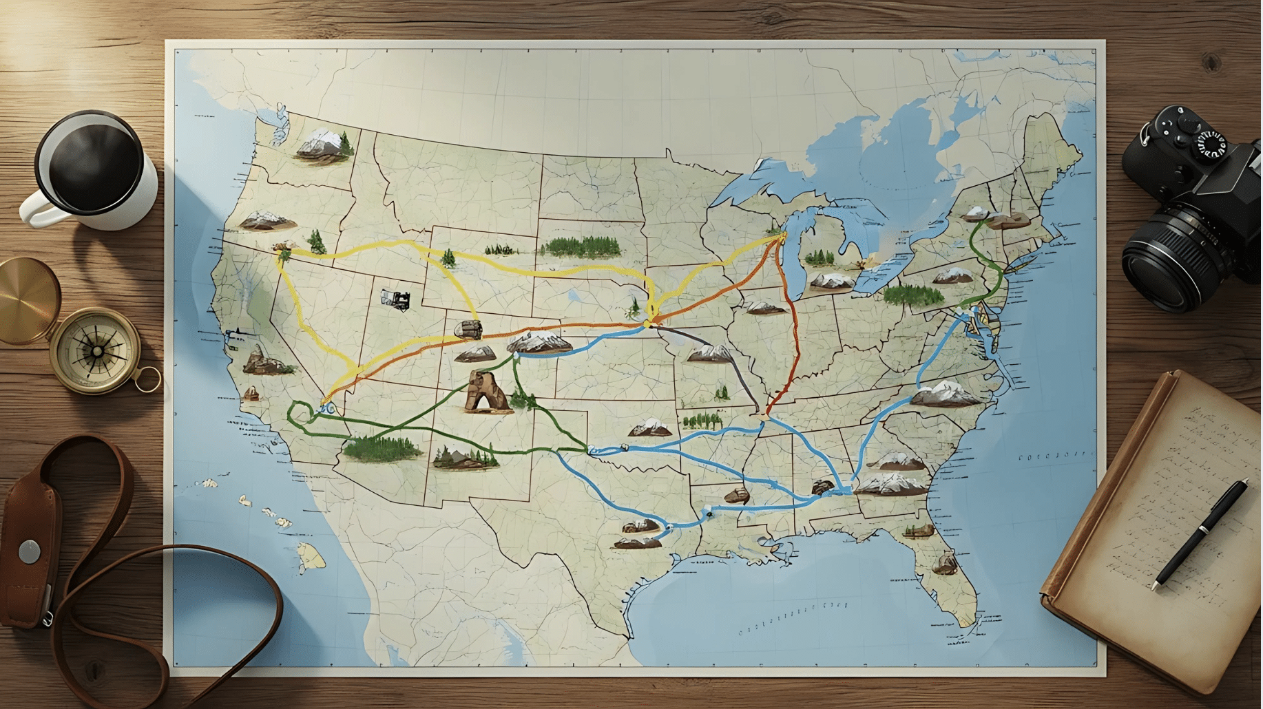
Creating your national park road trip map starts with choosing from proven routes that connect multiple parks efficiently. Your route choice depends on available time and seasonal preferences.
1. The Grand Loop Route
The most complete option covers 12,000-15,000 miles over 6-8 weeks, connecting America’s most iconic parks.
Start in California or Colorado and travel clockwise through western desert parks, north to mountain regions, across to the Pacific Northwest, and through eastern parks.
This route follows seasonal weather patterns naturally while minimizing backtracking.
Route Highlights:
- Key Parks: Death Valley, Yosemite, Zion, Bryce, Arches, Rocky Mountain, Yellowstone, Grand Teton, Glacier, Olympic, Mount Rainier, Great Smoky Mountains, Acadia
- Best Season: April through October
- Gateway Cities: Los Angeles, Las Vegas, Denver, Salt Lake City, Seattle
This route delivers maximum variety, taking you from Death Valley’s extreme desert heat to Glacier’s pristine alpine wilderness in one continuous loop.
2. Western Icons Route
Perfect for 2-3 week trips focusing on desert and mountain landscapes.
Connect California’s Sierra Nevada parks with Utah’s red rock country using I-15 and scenic Highway 12. This route showcases America’s most photographed landscapes with manageable driving distances.
Route Highlights:
- Key Parks: Death Valley, Sequoia, Yosemite, Zion, Bryce Canyon, Arches, Canyonlands
- Best Season: April-May, September-October
- Gateway Cities: Los Angeles, Las Vegas, Salt Lake City
Photography enthusiasts love this route for golden hour lighting conditions and iconic formations that define the American West.
3. Mountain West Route
Summer-focused route for wildlife viewing and alpine scenery when high-altitude roads stay open.
This route offers excellent wildlife opportunities from grizzly bears in Yellowstone to mountain goats in Glacier. Famous scenic drives like Going-to-the-Sun Road remain fully accessible during the summer months.
Route Highlights:
- Key Parks: Rocky Mountain, Yellowstone, Grand Teton, Glacier
- Best Season: June-September
- Gateway Cities: Denver, Jackson, WY, Kalispell, MT
Wildlife photographers find this route unmatched for capturing bears, wolves, elk, and mountain goats in their natural habitats during peak activity periods.
4. Pacific Northwest Route
Combining coastal rainforests with volcanic peaks in cooler weather conditions.
This route features unique ecosystems from temperate rainforests to volcanic crater lakes. The maritime climate provides comfortable hiking conditions even during the summer months.
Route Highlights:
- Key Parks: Olympic, Mount Rainier, North Cascades, Crater Lake
- Best Season: July-September
- Gateway Cities: Seattle, Portland
Nature lovers learn about ecosystems found nowhere else in America, from moss-draped old-growth forests to crystal-clear alpine lakes reflecting volcanic peaks.
5. Eastern Heritage Route
Historical and cultural parks from Maine to Florida to Texas, ideal for fall colors and winter travel.
This route combines autumn foliage displays with rich cultural history and diverse ecosystems. Eastern parks offer well-developed trail systems and proximity to major cities.
Route Highlights:
- Key Parks: Acadia, Shenandoah, Great Smoky Mountains, Everglades, Big Bend
- Best Season: April-May, October-November (northern parks), December-March (southern parks)
- Gateway Cities: Boston, Asheville, NC, Miami
History buffs appreciate the combination of natural beauty with Civil War battlefields, Appalachian culture, and Native American heritage sites woven throughout these parks.
Route Selection Tip Choose based on your available time and preferred season. Shorter trips work better with regional routes, while 6+ weeks allow the full Grand Loop experience. |
Recommended Days per National Park
Planning your national park road trip map requires realistic time allocation for each destination. Most travelers underestimate how much time they need, leading to rushed experiences and missed opportunities at these incredible locations.
Major Parks (Extended Stays):
- Yellowstone: 5-7 days for geysers, wildlife, and multiple regions
- Yosemite: 3-4 days for the valley floor and high country areas
- Grand Canyon: 3-4 days for rim exploration and hiking opportunities
- Great Smoky Mountains: 3-4 days for extensive trails and historic areas
Popular Parks (Standard Visits):
- Zion, Glacier, Rocky Mountain, Grand Teton, Olympic: 2-3 days each
- Bryce Canyon, Death Valley, Sequoia, Mount Rainier, Acadia: 2 days each
Compact Parks (Quick Visits):
- Arches, Crater Lake: 1-2 days for main attractions and scenic drives
Your national park road trip map timing should include travel days between distant parks plus rest days for trips exceeding two weeks.
Weather delays and seasonal road closures may extend stays, particularly in mountain regions during the shoulder seasons.
Road Trip Planning and Permits
Smart planning turns your national park road trip into a smooth, memorable experience. Focus on timing, reservations, and costs to avoid disappointment.
Popular national parks now require advance reservations during peak seasons. These timed entry systems require careful planning ahead of your trip.
| Park | Reservation Period |
|---|---|
| Yosemite | May-September |
| Glacier | June-September |
| Rocky Mountain | May-October |
| Arches | April-October |
| Zion | March-November |
Understanding park fees and pass options helps you budget effectively.
Book reservations 5 months ahead at recreation.gov (10 AM ET for best availability). The America the Beautiful Annual Pass ($80) covers all park entrances and pays for itself after 3 visits.
Most parks charge $30-35 per vehicle without the pass. Free entry days: January 20, April 19, August 4, September 28, and November 11.
National Park Trip Safety
Responsible travel in national parks requires following basic safety protocols and conservation principles. These guidelines protect both visitors and the natural environments that make these parks special.
- Always store food in designated bear boxes or hard-sided containers, and carry bear spray when traveling through bear habitat
- Maintain safe distances from wildlife: stay at least 25 yards from most animals and 100 yards from bears, wolves, and other large predators
- Monitor weather forecasts and road conditions daily, particularly for mountain passes, and carry emergency supplies including extra water, warm clothing, and a first aid kit
- Follow Leave No Trace principles by packing out all trash, including food scraps, camping only in designated areas, and staying on established trails
- When permitted, use only established fire rings, keep fires small using local dead wood, and ensure fires are completely extinguished before leaving
- Never feed wildlife or remove natural objects like rocks, plants, or artifacts from parks
- Be considerate of other visitors by keeping noise levels appropriate and allowing others to enjoy the natural quiet of this protected space.
Final Thoughts
Your national park road trip map serves as more than just a planning tool; it becomes the foundation for life-changing adventures across America’s protected landscapes.
The complete Grand Loop route and focused regional segments both offer incredible experiences when properly prepared.
Successful multi-park adventures depend on advance reservations, seasonal timing, and understanding each park’s unique requirements.
The routes outlined here connect incredible destinations while following natural weather patterns and logical driving sequences.
Your national park road trip map reveals diverse ecosystems, wildlife encounters, and photographic opportunities that create lasting memories from desert wilderness to alpine peaks.
Ready to start planning your national park road trip map adventure?
Share your favorite route ideas or ask questions about specific park combinations in the comments below.